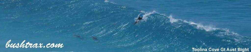


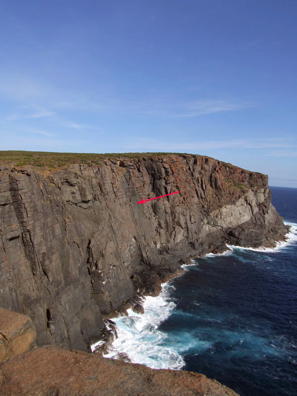
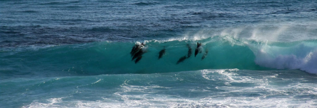
 @ Conspicuous Cliffs


 @ Peaceful Bay
 Windy Harbour
There are 3 tracks that you can access at Peaceful Bay, these are--> Rame Head rd PB05, The Gap PB23, Soft Beach PB59


The Rame Head track is black sugar sand and has rubber matting spiked into the ground at all the difficult spots. As you descend to the junction at P17, the track is in very good condition and will bring you onto a small beach. From here you will have to travel along the beach until you follow the track over the rocks(PB19) to access the 2nd beach.
The descent on the other side of PB19 may not be suitable for vehicles with low ground clearance. There is a small parking area at the top of the track where the above photo was taken (PB19). It is approximately a 650m walk from here. Driving along the 2nd beach will bring you to the rocks at PB20. Rame Head is about a 350m walk from here.


The Channels can be accessed via a short track from PB18. You can drive all the way round the point to access Salmon Camp beach from here. Taking this route is only practical if prevailing conditions permit this. Salmon Camp beach can be accessed from PB17. The track in is steep with a 180 degree turn at PB22.


The Gap track starts at PB23 and is similar to the Rame Head track. The track will take you to a beach that when conditions allow, you can travel east along the coast and exit via the Soft Beach track. Access to this beach will be greatly affected by the swell and tide.


The Soft Beach track starts at PB59 and as the name implies the beach and track are soft. This track will take you out to Point Irwin where a series of sidetracks will take you to a variety of places. The Gropher Holes is accessed via a sidetrack at PB55. Travelling further along you will find Cape Hope, Kingy Rock, Diamond Rock and Castle Rock. This stretch of coastline is extremely dangerous to fish from the rocks.


The Blue Holes lies to the east of Nornalup and within the confines of the Walpole/Nornalup National Park. Officially known as Bellanger Beach it is a great beach for fishing.


The approach tracks to the beach are excellent with railway sleepers at the difficult hill climbs. The beach is very soft as is the ascent behind BLU13. The bigger 4wds will find it easier to let your tyres down around BLU10. You can access the Nornalup Inlet mouth from BLU16, though this will depend on beach conditions. The beach does carve out big blue holes which is good for fishing but restricts access to the rest of the beach.


Right click mouse and use scroll wheel to zoom the map below. You can also access the free map at maps.bushtrax.com where you view and download the map in the .mbtiles format. We have provided information about some apps that will handle this map format. Using your mobile to view in landscape mode is best.

 >
> 

 @ Four Mile Campground. >> Mary Ann Haven
There are 3 ways to enter the park. The first is at the corner of Hammersley Drive and the South Coast Hwy. Hammersley Drive is a gravel rd within the confines of the park. Alternatively you can enter Hammersley Drive just before Hopetown off the Ravensthorpe-Hopetown rd. The third is Moirs rd which starts in the town of Ravensthorpe. Moirs rd eventually runs into Moirs track which is 4wd only and follows the Philip River for a way and runs into Hammersley Drive. There are gates at either end of the Moirs track and if they are locked at the Ravensthorpe end you may have to back track along John Forrest rd.
It does pay to check the DPaW regarding access in the colder months.


The Quoin Head track is hilly and steep in spots and does cross the Hammersley River. There are no special vehicle requirements and just before you actually get to the beach at Quion Head there is a very steep descent. There is a rough track that connects from Quoin Head to Whalebone Beach. This track has a nasty creek bed (FTZ09) that will require a degree of ground clearance and possibly low range, not reccomended for low vehicles. The track runs along small ridges and will take you over a small creek (FTZ11) and bring you to the beach at FTZ12.


Along the Quoin Head track you will see the Whalebone Beach track junction (FTZ27). This is an easy track to drive and will take you to Whalebone Beach and the western side of the Hammersley Inlet mouth. There is a descent to the beach(FTZ17) here and it is steep and soft(can be closed at times).
You will find camping at the end of Hammersley Inlet road. Along the Hammersley Inlet rd you will see access to the beach at FTZ71. This track will take you through the Hammersley sand dunes to the beach. It is easier if you let your tyres down as it can be soft in spots. There are a series of posts that will define a path for you to follow.
There is also camping at the 4 mile camping area. This is near Barron 's Beach and the eastern entrance (Hopetown end) of the park. There is also camping at Quion Head. There are clearings along the northern end of Moirs Track that allow camping along the Philip River.
 FTZ39")

Right click mouse and use scroll wheel to zoom the map below. You can also access the free map at maps.bushtrax.com where you view and download the map in the .mbtiles format. We have provided information about some apps that will handle this map format. Using your mobile to view in landscape mode is best.
 @ Shelley Beach Albany
Turning into Pikadon rd off the Lower Denmark rd will eventually bring you the intersection of Shelley Beach rd. Here it is a short trek along a gravel rd to Shelley Beach and the lookout. Shelley Beach is a small stretch of beach laying at the base of some very steep hills which sometimes attracts hang gliders that launch from the lookout above. Also a popular camping spot.
JAN 16, The actual West Cape Howe track system has become very soft sugar sand. The conveyor belt matting in some spots has come loose. The main track on the western side is reasonable but you will have to drop your tyre pressures very low. In some cases the heavier vechicles could be as low as 18lbs. The eastern tracks out Dunsky Beach involve climbing soft hills with "jump ups" at the top. Tyre pressures could be as low as 14lbs over that side. We helped a VW ute out, it was just a case of lowering tyre pressures till it got out.


The western side of West Cape Howe has the best access to view the surrounding coastline. The coastline is extremely dangerous with regards to fishing. The eastern side of the park is where the fun is. Dunsky Beach has a camping area just back from the beach, with excellent shelter from the wind etc. The high point at WCH18 offers some spectacular views.


There are two access roads into Bornholm Beach namely, Shepherds Lagoon rd which is the most direct route, with the best access. Bornholm South rd ends at private property. You will find the entry point hidden behind the overhanging trees on the left. From here you will travel through a heavily wooded section and then over a series of hilly/sandy tracks. Both rds are clearly sign posted on the Lower Denmark Rd.
The beach is a favourite with fisherman chasing salmon. At the bottom there is a track that will take you onto the beach allowing you access in either direction. A word of warning this place can stop you in your tracks due to the incline of the hill climb, very soft sand with a few woop de doos thrown in to top off. If you get stuck the only way out is to walk back to the road and find the local guy who owns a tractor (this will cost you).


Right click mouse and use scroll wheel to zoom the map below. You can also access the free map at maps.bushtrax.com where you view and download the map in the .mbtiles format. We have provided information about some apps that will handle this map format. Using your mobile to view in landscape mode is best.
 Mary Ann Haven
The township of Bremer Bay lies on the Bremer River. Access to the Gordon Inlet,Peppermint Beach Tooregullup Beach that are to the east of the town involves crossing the sand bar. The beginning of Gordon Inlet rd starts at the trees area on the other side of the sand bar. The road itself is gravel and eventually runs into a 4wd track that will take you to the Gairdner River mouth.
The river mouth track is quite easy to negotiate. As you proceed along here you will come across a shack, where it is probably a good idea to let your tyres as continuing further takes you onto the approach track that changes to soft white dune sand with bends and small hills. There are also 2 sidetracks off Gordon Inlet rd that allow you to connect to a 4wd track (very easy) that follows the inlet/river back to Gairdner rd.
")
")


Doubtful Islands rd is similar to Gordon Inlet rd and will take you to the Peppermint, House and Whalebone beaches. There are Salmon fishing camps at House and Whalebone beaches. Peppermint beach has camping areas along the track. The tracks around here are easy forestry tracks though the access to the beaches may require that you let your tyres down.


The area out towards Point Henry has very easy access to Blossoms Beach. There is no vehicle access to Short Beach. All the other tracks out to the point are sandy/rocky terrain and very easy to negotiate. The coastline is generally elevated granite sloping to the ocean.
The access track that lays at the end of Black Rock rd provides 2 actual ways onto Dillion Beach. The first at BB45 and and the second at BB44. BB44 can form a steep drop to beach level sometimes due to the actions of the tides and swell.


Dillion Beach can be accessed via a track that runs thru private property (conditions apply) at the end of Dillion Bay rd. You can also access the eastern end of the beach from Black Rock rd. Both tracks and the beach are best travelled with low tyre pressures.
There is a small headland at BB55 that entails negotiating a elevated rocky track to access BB56. The track off the beach at BB56 has a rough hill climb that may draw attention to your vehicles ground clearance.


Stream Beach is a very picturesque place and means tackling a steep sandy track (500m) that follows a gully between two hills. Fosters is an excellent surf fishing beach. Finding you way onto Fosters Beach can be tricky due to the fact the dune area is moving and the actual position of the track may change.
The access point that we found actually pointed in the opposite direction to our direction of travel in. Around the track/dune area the bush consists of small trees and as you move towards BB62 changes to a tight track with harsh scrub right up to the sides, eventually getting worse and ending in a cul-de-sac.
Navigating thru the dune area can be hazardous for the unwary, though keeping the bush within sight on your right will bring you to a defined track that will take you down to the beach between two hills. There is another track off the beach at the western end and this is very sandy and steep. Though we did not travel this, an enquiry to a local pointed out that it exits/starts at the two strainer posts within the first 1.5km in and could possibly be called Minarup rd.


Reef Beach can be accessed via Reef Beach rd or Warramurrup rd. Warramurrup rd starts out as gravel and runs into a sandy track. The descent to the beach is steep with thick vegetation right up to the sides of the track, making passing oncoming traffic near on impossible.
Reef Beach rd is the better choice as it consists of gravel,limestone and sandy sections. Reef Beach rd could also be affected by heavy rains judging by the wash outs. The beach itself is also very soft and will require low tyre pressures.


Right click mouse and use scroll wheel to zoom the map below. You can also access the free map at maps.bushtrax.com where you view and download the map in the .mbtiles format. We have provided information about some apps that will handle this map format. Using your mobile to view in landscape mode is best.