Moores Track

- The Coodamurrup Beach track is very good only getting soft as you ascend the first dune at MT28. The Fish Creek track entails crossing the creek and some hill climbs with woop de doos. There is a creek crossing on Chesapeake rd that may become impassable. There are alternative routes via Deeside Coast rd or Gardiner River rd.
- Contact: DPaW Pemberton Phone: (0)8 9776 1207 DPaW Parks and Wildlife


- Nearest service:Northcliffe / Windy Harbour


- Track Length: 46km
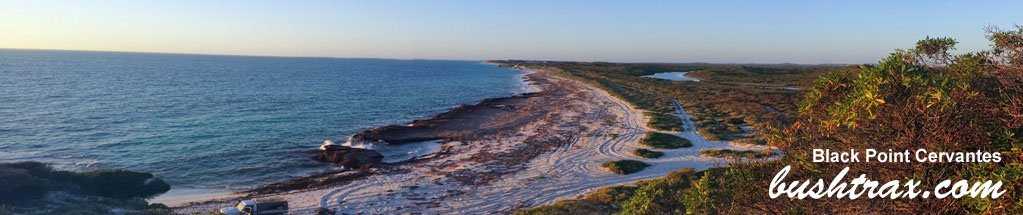
 Windy Harbour
- Distance from Perth: Northcliffe 357km
Northcliffe to MT01 via Chesapeake rd 34km
Northcliffe to MT01 via Deeside Coast rd 42km
Northcliffe to MT01 via Gardiner River rd 40km
Walpole to MT01 74km - StreetSmart®Travellers Atlas 9th Edition Map: Map: 9 Grid Ref: B
- Roads and Tracks Western Australia 2005 Map:1 A Grid Ref: A 1
Moore 's track runs off Chesapeake rd that branches off the Windy Harbour rd south of Northcliffe. Chesapeake road runs through the last of the swamps in the D'Entrecasteaux National Park so the road can be affected by excessive rains even though it is gravel.
As you leave the swampy environs and once again enter tall timber country the rd is in excellent condition. The track is sign posted. At the time of writing the western end of Chesapeake was closed due to a bridge being damaged. Alternate access can be found by coming down Deeside Coast rd.


The first T-junction (MT02) is clearly visible as you travel along the track. Here you can either turn towards Fish Creek or Coodamurrup Beach. Moore 's Shack lays along the Coodamurrup Beach fork of the track and is an easy forestry track. Set amongst a well shaded area, it is a ideal place to camp.
Traveling further along the track for 2km brings you to Coodamurrup Beach (MT30). There are campsites near the first dune you have to tackle at MT28 and another bigger camping area is just behind the coastal dunes at MT29. The shortcut across to Fish Creek from Moore 's Shack is directly in front of the shack heading east.


The Fish Creek track will take you to two points on the coast. MT16 has bush right up to the sides of the track and a small parking area. There is a walking track to the beach from here. It would be approximately 1.5 kms to the inlet sandbar from MT16. MT17 is a more open area and offers the best views of Broke Inlet beach.
The West Cliff Point track will take you around the sandy hill climbs (MT07) and Fish Creek if it is flooded. There is only one easy hill climb along here and will bring out just west of West Cliff Point.


The Fisherman's track is is an open track that will bring you to the Fisherman's Shack. Following the track up and along the ridge after Fisherman's Shack will bring you to a small bay at MT22. The next obstacle is the hill climb at MT23 and then a easy descent to the beach at MT31.
The Fish Creek campsite track starts off easily enough and eventually the prickly scrub grows right up to the edge of the track. At MT18 there is a sharp �90 turn with a jump up in the track. The campsite (MT19) is a short distance from here and is nestled in a small hollow with plenty of shade. Traveling past MT19 puts you onto a very tight track with no option of turning around or alighting from the car for that matter, till you reach the single car parking area at MT20.


The other two ways to get to Chesapeake rd from Northcliffe are either Deeside Coast rd (long way) or Boorara rd just south of Northcliffe along the Windy Harbour rd. Turn right into Boorara rd then you will pass through a small industrial area, the roads are sign posted and will guide you to Chesapeake rd. A GPS or map is handy as the area is heavilly forested and a sense of direction is hard to "see".The below photograph was taken in Feb 14, a Hire Toyota Hilux 4x4 with a "big" camper on the tray passed thru easily.


.jpg "Moores Shack")
.jpg "MT23 Hill Climb.")
a.jpg "MT23, Typical terrain")
b.jpg "MT23 West Cape Howe east side")
.jpg "Small bay at MT21")


Right click mouse and use scroll wheel to zoom the map below. You can also access the free map at maps.bushtrax.com where you view and download the map in the .mbtiles format. We have provided information about some apps that will handle this map format. Using your mobile to view in landscape mode is best.