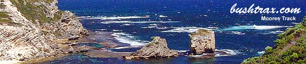
Butty Head & Rose's Beach

- Butty Head is a short drive west of Esperance. The track to Roses Beach (western end) can be impassable during winter. The descent to Plumpudding Beach is a easy track though you will have to swing hard left across the rocks to get onto the beach at the bottom. The track that takes you out to Butty Head has a very soft section at the bottom of the hill at BRB26, there is no run up off the beach. There are shifting sand dunes at BRB28 that may make the track impassable.
Roses Beach (west) can be accessed at the end of Murray rd which is about 35km west of the 11 Mile Beach rd and SW Highway junction. At the end of Murray rd the track starts straight ahead behind the trees (BRB40). The sign says it all from here for about 1.1kms where at BRB41 the track will swing to your left and travel along a fenceline. From here on the track will begin to open up and it is a very easy drive to the beach - Contact: DEC Esperance Phone: 08 9083 2100 92 Dempster Street Esperance


- Nearest service: Esperance


- Track Length: 33km
 Esperance
- Distance from Perth: Esperance 720km Then 19km out to 11 Mile Beach Road
- StreetSmart®Travellers Atlas 9th Edition Map: 46 Grid Ref: C 5
- Roads and Tracks Western Australia 2005 Map:11 Grid Ref: C 4
The track to Butty Head is a very easy track for its length. At BRB08 if you wish to stay away from the beach it is best to turn right. The next junctions after BRB08 are on your right and take you to the large dune areas that are to your north.
The quickest way to the beach is to continue straight at BR08. The sand track is not steep, though it may require low tyre pressures to get back up. The other way to the beach is at BRB12. The direction of the wind can change the physical shape of the coastal dune that the track goes over.


A short distance after BRB12 you will have to tackle the small hill climb (BRB13) and then pick your way through the low dunes as you approach the main dune area. The way through the main dune area is well defined. From BRB16 to Plumpudding beach the track can be quite tight with thick scrub sometimes right up to the edge of the track.
There are a couple of points where cars may pass, other than that just hope no one is coming the other way (BRB18/19/19a). The descent to Plumpudding Beach is a easy track though you will have to swing hard left across the rocks to get onto the beach at the bottom.
The track that takes you out to Butty Head has a very soft section at the bottom of the hill at BRB26, there is no run up off the beach. There are shifting sand dunes at BRB28 that may make the track impassable.


Roses Beach (east) can be accessed at BRB16 or 15. The track will bring you to a hilltop that is made up of capstone and drifting sand. From BRB38 there is no defined track until you pick your way down towards the beach. The drift sand can be very soft and the drop-offs quite sudden.


Roses Beach (west) can be accessed at the end of Murray rd which is about 35km west of the 11 Mile Beach rd and SW Highway junction. At the end of Murray rd the track starts straight ahead behind the trees (BRB40). The sign says it all from here for about 1.1kms where at BRB41 the track will swing to your left and travel along a fenceline. From here on the track will begin to open up and it a very easy drive to the beach.


Right click mouse and use scroll wheel to zoom the map below. You can also access the free map at maps.bushtrax.com where you view and download the map in the .mbtiles format. We have provided information about some apps that will handle this map format. Using your mobile to view in landscape mode is best.