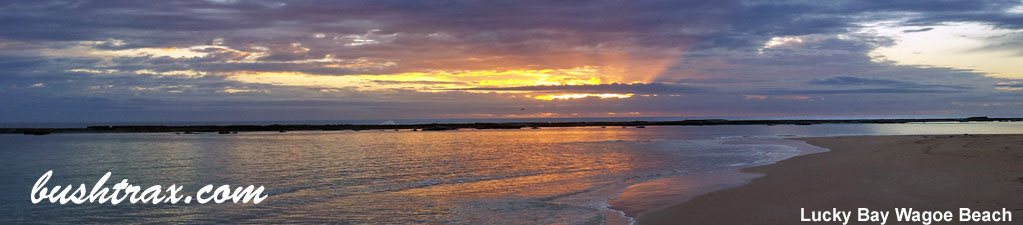
Wagoe Beach

- Wagoe Beach lies just to the north of Port Gregory. The southern end is accessible from George Grey rd, which gives you access to Sandalwood Bay and Lucky Bay. The beach will be very soft for vehicles. As of January 17 a fee of $15 per vehicle will be required per night.
- Contact: Northampton Shire


- Nearest service: Kalbarri 41km / Northampton 65km


 Gregory
- Track Length: 30km
- Distance from Midland: Sandlewood Bay rd and Grey rd 520km
- StreetSmart®Travellers Atlas 9th Edition
- Roads and Tracks Western Australia 2005
Wagoe Beach with its proximity to Port Gregory & Kalbarri is worth having a look at. The township rests on a peninsula between the ocean and some vast mud flats. On the way into Port Gregory you will pass the convict ruins at Lyndon Station and the Hutt River also meets the ocean just after it.
Port Gregory has a Caravan Park and general store. There is an offshore reef that provides shelter for the crayfishing fleet, a jetty for the kids to fish off and good boat launching facilities. Hutt River can be accessed quite easily & is only a short drive from the main rd.


The other part of the coast worth exploring is Three mile beach that lies to the north west of the launching facilities. You can attempt the beach run or alternatively take the track that is behind the gravel clearing near the boat ramp. It is rather hilly towards the end, as you approach the beach. The beach consists of broken reef and sandy stretches and looks like there would be some big Tailor lurking around here.


Generally there are not a lot of accessible tracks around Port Gregory itself, though further to the north lies the stretch of coast called Wagoe Beach. Wagoe Beach offers some excellent fishing and plenty else to do with regards to off road vehicles. Follow Grey rd towards Kalbarri for about 20 km and there will be gravel rd heading west.
It is then a short drive till you come to a T-junction turn right here. The track itself is in very good condition though there is a bog hole at wpt 9 that will present problems after rain. The area around the base of the sand dunes is of a low lying nature, so the track may become impassable in the depths of winter. The small bay (wpt 11) at the base of the dunes offers sheltered water, with the southern point attracting a lot of interest from fisherman. Travelling further south will take you to a small hamlet of fishing shacks (wpt 14). The beach directly in front of these offers some excellent fishing also.


Travelling north of Wagoe Beach, you will have to tackle the beach to get to the beginning of the cliffs that run to Kalbarri. Wagoe Chalet's allow access to this part of the coast. Unfortunately you have to stay at the chalet 's to use the access track to the beach through their property.Their website will provide all the DETAILS If you are a fisherman or offroader this a must see stretch of coastline.
Right click mouse and use scroll wheel to zoom the map below. You can also access the free map at maps.bushtrax.com where you view and download the map in the .mbtiles format. We have provided information about some apps that will handle this map format. Using your mobile to view in landscape mode is best.