


 @ Seal Cove, Black Point and Lake Jasper
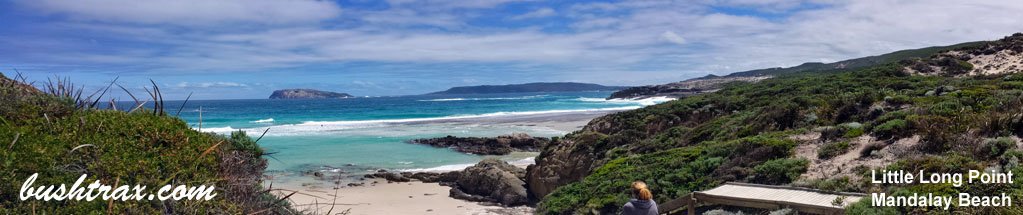
 Flinders Bay
Leaving Perth and finding your way to Karridale turn left into Brockman Hwy and travel east till you come to the intersection of Brockman Highway and Scott River rd (BP01). Alternatively you can get to the Brockman Hwy by turning into Sues rd which starts just north of Busselton and cross's the Vasse Hwy. Scott River rd will take you to the western end of Milyeannup Coast rd (BP04). Turn left here and follow this due east until you come to the intersection of Milyeannup Coast rd and Woodaburrup rd (BP06).
Turning right at BP06 brings you onto Woodaburrup rd. It is only a short distance to a fenceline and sign (BP07) displaying a collection of distances concerning Woodaburrup rd. The Gingalup Swamps turnoff (BP09) is nestled amongst the trees.
The track takes you to a parking area in dense bush. Heavily forested, tight in places and extremely popular with Tiger snakes. The White Point turnoff (BP13) will take you to the White Point shack. The area is well shaded. Please be aware that it is private property so please keep it clean if you frequent the area. parking area.


The junction at BP15 follows a fenceline with some sandy hill climbs. The Black Point turnoff (BP19) announces its self as a large junction. The tracks into and around Black Point can be very soft and will require dropping your tyre pressures. There is no camping at Black Point itself. The camping areas (BP 21 & 25) are at the end of the side tracks that you will see onthe way in.
There are toilets located at Black Point carpark(west) BP22. Jasper Beach can be accessed at the next T-junction (BP28) that you come too after leaving Black Point. The camping area (BP32) is also back from the beach. Lakes Jasper (BP34), Wilson (BP36) & Smith (BP38) are the next points of interest.
You can camp at spots near Lake Jasper and have an interesting drive through the railway sleepered swamp on the way there. Lakes Wilson and Smith lie at the end of short sidetracks.


The eastern end of Jasper Beach (BP45) only allows walking access to the beach.There are camping spots on the way in. There is a walking track that will take you to the beach east of here. Access to the eastern end of track system is now via Pneumonia rd which runs off Stewart Rd. Scott rd to Vasse Highway is closed


Right click mouse and use scroll wheel to zoom the map below. You can also access the free map at maps.bushtrax.com where you view and download the map in the .mbtiles format. We have provided information about some apps that will handle this map format. Using your mobile to view in landscape mode is best.
 Hamelin Bay
Boranup Forest is actually part of the Leeuwin National Park and is tall timber country. The main reason for having a 4wd here is the steep descents and the ground clearance required to get over the diversion banks. These are in place to protect the track from the run-off after the winter rains.
The lookout provides a magnificent view of the surrounding area. There is a camping ground just off Conto rd. Just before the intersection of Georgette and Point rd there are also camping and picnic facilities here in a bush setting.
Hooley, Boranup & Grace rds are all steep hill climbs and very easy to negotiate. Trig rd can be a bit tight to begin with at the Grace rd end, but is a good shortcut across to North Point. Not a full on 4wd track system though the Salmon fishing can be quite good north of Hamelin Bay in season.
If you camp at the Point Rd camp site be aware that the local possums come out at night. They can rummage through your gear and even the back of a ute, make sure every thing is secure.


The Bobs Hollow track is an easy track to negotiate except for the bloody rocks that are littered along the track as you approach the coast. The most comfortable course of travel is along Bobs Hollow rd (BH01). This track starts about 1.9km south of Calgardup rd.
The entry point at BH09 is by a National Park sign, although not a rough track, into the coast it is flanked by prickly scrub right up to the side of the track. The southern fork(BH08) to Bobs Hollow also is littered with rocks. The Connelly Cave track also has rough outcrops also. The rocky outcrops may present problems to vehicles with low ground clearance.
")


There are 2 tracks along the Cosy Corner rd. The first (CC02) will take you to a rest area (CC19). Traveling to the end brings you to a dead end (CC20 in sight of Deepdene Beach. There is only walking access from this point.
The second track (CC03) will take you to Elephant Rock and Deepdene Beach. The first junction (CC05) takes you to Cosy Corner beach. The track can be soft and has a section that needs some ground clearance to get over the woop-de-doos at CC06. There is only walking access to the beach.
Traveling further onto Elephant Rock is quite easy. There is soft section at CC10, although a fork in the track enables you to detour around it. Turning south at CC11 will take you to Deepdene Beach. Coming back to the bumpy section at CC13 is the only obstacle.


Right click mouse and use scroll wheel to zoom the map below. You can also access the free map at maps.bushtrax.com where you view and download the map in the .mbtiles format. We have provided information about some apps that will handle this map format. Using your mobile to view in landscape mode is best.
 Hamelin Bay
@ Seal Cove, Black Point and Lake Jasper
Flinders Bay
Hamelin Bay
@ Seal Cove, Black Point and Lake Jasper
Flinders Bay @ Banksia Camp or Crystal Springs


 Windy Harbour
  Windy Harbour
  Windy Harbour