


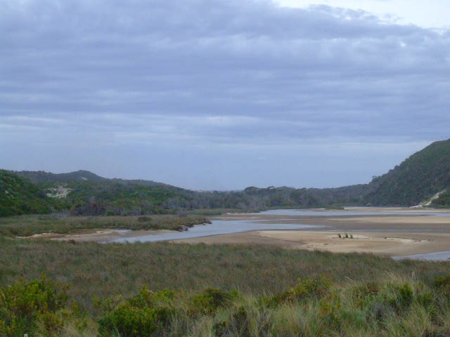
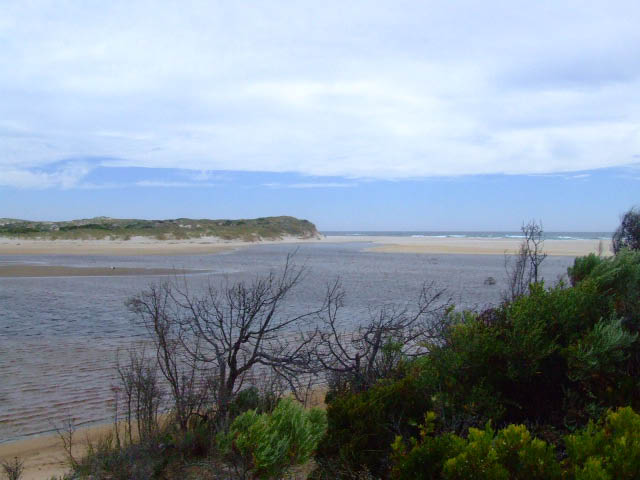
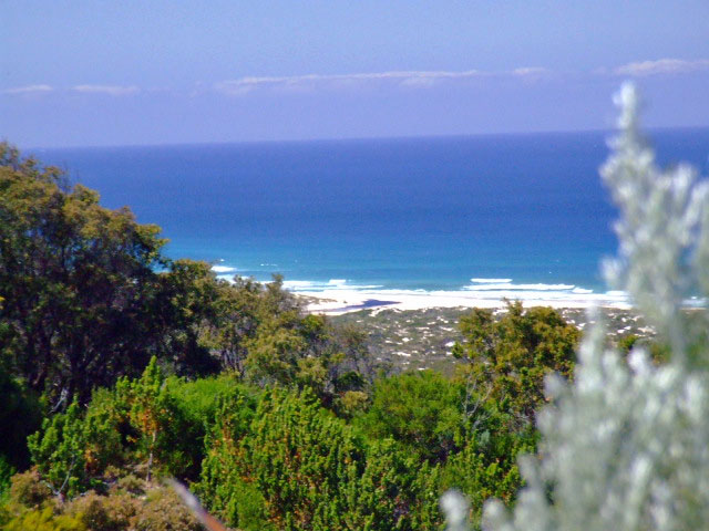
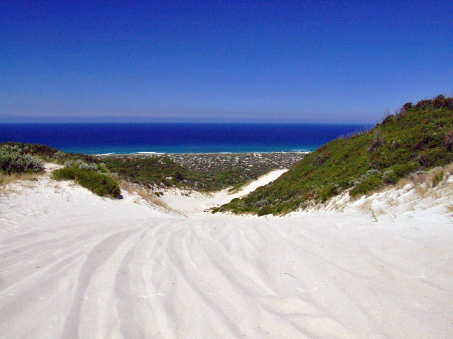
 Windy Harbour
The water affected 4wd track during winter follows the Doggerup Creek for a couple of kilometers. Even in Febuary the water holes can be up to the running boards. After the swampy environs the track tends to become soft black sand, requiring the lowering of tyre pressures. Best spot to do this is the clearing at the very beginning of the track.


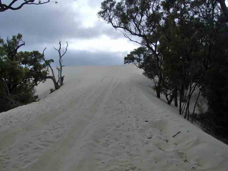
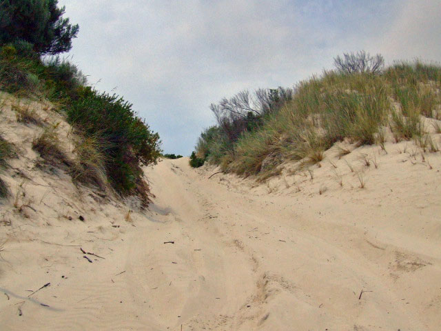
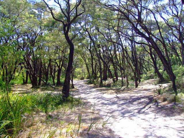
As you approach the coast the track will meander through lightly tree'd, hilly terrain. The final obstacle is a small sand dune (ST04). Depending on the winds this can be easy or interesting. Interesting in the sense that the winds can blow the drift sand onto the track and create a soft peak, with a daunting sideways angle on the other side. If your not sure have a look over the other side first.

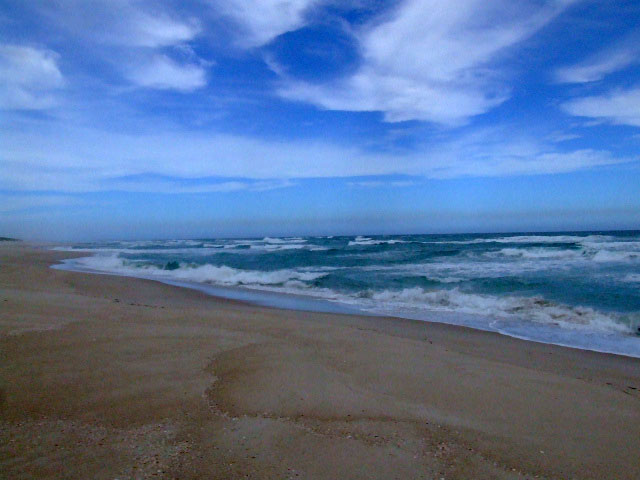
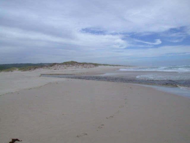
Following the track parallal to the beach brings you to a small creek that feeds in from the hills to the ocean. There is easy access to the beach itself just after you cross the creek. The track does continue further west behind the coastal dunes for abour 5km. There are a few access points to the beach along here also.


Right click mouse and use scroll wheel to zoom the map below. You can also access the free map at maps.bushtrax.com where you view and download the map in the .mbtiles format. We have provided information about some apps that will handle this map format. Using your mobile to view in landscape mode is best.

 Windy Harbour
The northern entry to the Warren River access track is on the Old Vasse Rd (WR01) which branches off the Vasse Highway. Approximately 500m in from the highway on your right you will find Ritter rd (WR02). Turn right into Ritter rd and follow the gravel rd to Lake Yeagarup (WR03). Arriving at the pay station you will have to part with $9 to access the track to the Warren River beach. Following the track towards the beach, the Yeagarup Dunes announce themselves at WR04. There are parking areas here where you can let your tyres down, before tackling the dunes.
The track through the Yeagarup Dunes is marked with a series of posts in the ground and is about 2.5km in length. The entry point to the next dune area entails descending through a bottleneck at WR10. This area is as steep as it gets west of the Warren River. There is a track that runs behind the dunes that will take you to the Warren River (WR15) if beach conditions don,t allow access to the beach. The area around the entry track (WR13) to the beach has some clearings that could be used as campsites .There are no facilities here at all and you will have to carry everything in and out.
The eastern side of the Warren River can be accessed from the intersection of Richardson rd and Lewis rd. Following the gravel rd for about 5.5km you will eventually run onto the sandy track. The track can be loose sand in places, though there are railway sleepers at the bigger descents. There is a shaded camping area at WR39. There is a lookout that can be accessed on foot at WR40. Calcup Hill is the steepest sand climb around this area and even though the descent is spectacular the ascent will require very low tyre pressures (as low as 12lbs). Meerup River mouth can be accessed once you have reached the beach.
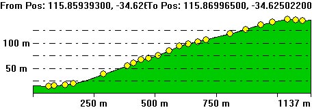
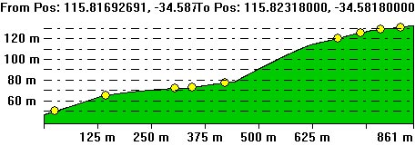
The following pictures are derived from a Digital Elevation Model (SRTM 3sec). The information is created by following the track with a line of sight tool. The images are to give you an idea of the descents and as always not entirely accurate.
Right click mouse and use scroll wheel to zoom the map below. You can also access the free map at maps.bushtrax.com where you view and download the map in the .mbtiles format. We have provided information about some apps that will handle this map format. Using your mobile to view in landscape mode is best.

 Windy Harbour
Moore 's track runs off Chesapeake rd that branches off the Windy Harbour rd south of Northcliffe. Chesapeake road runs through the last of the swamps in the D'Entrecasteaux National Park so the road can be affected by excessive rains even though it is gravel.
As you leave the swampy environs and once again enter tall timber country the rd is in excellent condition. The track is sign posted. At the time of writing the western end of Chesapeake was closed due to a bridge being damaged. Alternate access can be found by coming down Deeside Coast rd.


The first T-junction (MT02) is clearly visible as you travel along the track. Here you can either turn towards Fish Creek or Coodamurrup Beach. Moore 's Shack lays along the Coodamurrup Beach fork of the track and is an easy forestry track. Set amongst a well shaded area, it is a ideal place to camp.
Traveling further along the track for 2km brings you to Coodamurrup Beach (MT30). There are campsites near the first dune you have to tackle at MT28 and another bigger camping area is just behind the coastal dunes at MT29. The shortcut across to Fish Creek from Moore 's Shack is directly in front of the shack heading east.


The Fish Creek track will take you to two points on the coast. MT16 has bush right up to the sides of the track and a small parking area. There is a walking track to the beach from here. It would be approximately 1.5 kms to the inlet sandbar from MT16. MT17 is a more open area and offers the best views of Broke Inlet beach.
The West Cliff Point track will take you around the sandy hill climbs (MT07) and Fish Creek if it is flooded. There is only one easy hill climb along here and will bring out just west of West Cliff Point.


The Fisherman's track is is an open track that will bring you to the Fisherman's Shack. Following the track up and along the ridge after Fisherman's Shack will bring you to a small bay at MT22. The next obstacle is the hill climb at MT23 and then a easy descent to the beach at MT31.
The Fish Creek campsite track starts off easily enough and eventually the prickly scrub grows right up to the edge of the track. At MT18 there is a sharp �90 turn with a jump up in the track. The campsite (MT19) is a short distance from here and is nestled in a small hollow with plenty of shade. Traveling past MT19 puts you onto a very tight track with no option of turning around or alighting from the car for that matter, till you reach the single car parking area at MT20.


The other two ways to get to Chesapeake rd from Northcliffe are either Deeside Coast rd (long way) or Boorara rd just south of Northcliffe along the Windy Harbour rd. Turn right into Boorara rd then you will pass through a small industrial area, the roads are sign posted and will guide you to Chesapeake rd. A GPS or map is handy as the area is heavilly forested and a sense of direction is hard to "see".The below photograph was taken in Feb 14, a Hire Toyota Hilux 4x4 with a "big" camper on the tray passed thru easily.


.jpg "Moores Shack")
.jpg "MT23 Hill Climb.")
a.jpg "MT23, Typical terrain")
b.jpg "MT23 West Cape Howe east side")
.jpg "Small bay at MT21")


Right click mouse and use scroll wheel to zoom the map below. You can also access the free map at maps.bushtrax.com where you view and download the map in the .mbtiles format. We have provided information about some apps that will handle this map format. Using your mobile to view in landscape mode is best.
 @ Banksia Camp or Crystal Springs
 Mandalay Beach rd runs off the South West Hwy at a small hamlet called Crystal Springs. The beach is 8km from the Hwy and there is an excellent gravel rd all the way. There is no vehicle access, to Mandalay beach itself although the timber walking ramp and platform make the journey very easy if your looking for a swim or fish.


 from MB42 with the track winding down the hill")
Along the Mandalay Beach rd you will also see the turnoff to Banksia Hut. A fee of $9 applies to private vehicles to enter the park. The first junction will take you to Red Rock. The track ends at a parking area and entails, walking a short track to the coast. Following the main track from MB26 will bring you to MB28 where you veer left for the Banksia Hut camping area.
Banksia Hut has been rebuilt and at the time was quite close to being finished. A camping area with toilets is also a recent addition. The coastline lends itself to rock fishing more than beach fishing. It is a dangerous place to fish when a swell is running. If you are lucky enough to time your trip so that you can access the beach at Broke Inlet mouth (fishermans track) this may be the go. Contact DEC at the Wapole office on 98401027 to check access.
The track out to Bottleneck Bay and Cliffy Head can be a bit rough in spots for smaller 4wds. The Bottleneck Bay walking track is similar to the Hush Hush beach track


The other track system is on the eastern side of Mandalay rd & starts near the Crystal Springs camping area. Parts of the Bibbulmum Track interlace with the vehicle track system so be aware of hikers around here. The track can be quite soft, though railway sleepers or rubber matting are in place to enable easy accessability.
Long Point, Little Long Point, Hush Hush Bay & Lost Beach offer magnificent views of the coastline & beaches. There is no actual vehicle access to these places. There is no camping at any of the bays or open fires in any area of the park except the Crystal Springs camping area.
Long Point is a 350m walk to the beach.Little Long Point is 250m. Hush Hush beach requires at least a 250m walk down a very steep track to reach the rocks at the bottom.Lost Beach has a shaded parking area and entails a 150m walk to the cliffs. There is no track to Lost Beach from the top of the cliff that we could find.

")


Right click mouse and use scroll wheel to zoom the map below. You can also access the free map at maps.bushtrax.com where you view and download the map in the .mbtiles format. We have provided information about some apps that will handle this map format. Using your mobile to view in landscape mode is best.