West Cape Howe & Bornholm

- The track out to Dunksy Beach requires a soft sand hill climb with a "jump-up" at the top. Low clearance vehicles may have trouble (Jan 16). The track into Bornholm is not for the inexperienced. Very low tyre pressures (12lb psi) may be required as the sand is very soft. The area is very steep and the track has consistent woop de doos. When descending keep to the left hand track, as the track has little or no scope to allow two vehicles to pass each other. In a nutshell when you start the descent you may have to go all the way to the bottom enabling you to safely turn around.
- Contact: DPaW Albany 9842 4500 DPaW Parks and Wildlife


 @ Shelley Beach
 - Nearest service: Albany


- Track Length: West Cape Howe 12km Bornholm 11km
 Albany
- Distance from Perth: West Cape Howe(WCH01) 437km
- StreetSmart�Travellers Atlas 9th Edition Map: 4 Grid Ref: B / 3
- Roads and Tracks Western Australia 2005
Turning into Pikadon rd off the Lower Denmark rd will eventually bring you the intersection of Shelley Beach rd. Here it is a short trek along a gravel rd to Shelley Beach and the lookout. Shelley Beach is a small stretch of beach laying at the base of some very steep hills which sometimes attracts hang gliders that launch from the lookout above. Also a popular camping spot.
JAN 16, The actual West Cape Howe track system has become very soft sugar sand. The conveyor belt matting in some spots has come loose. The main track on the western side is reasonable but you will have to drop your tyre pressures very low. In some cases the heavier vechicles could be as low as 18lbs. The eastern tracks out Dunsky Beach involve climbing soft hills with "jump ups" at the top. Tyre pressures could be as low as 14lbs over that side. We helped a VW ute out, it was just a case of lowering tyre pressures till it got out.


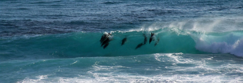
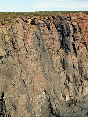
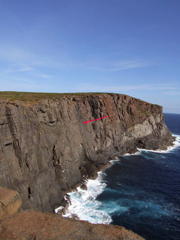
The western side of West Cape Howe has the best access to view the surrounding coastline. The coastline is extremely dangerous with regards to fishing. The eastern side of the park is where the fun is. Dunsky Beach has a camping area just back from the beach, with excellent shelter from the wind etc. The high point at WCH18 offers some spectacular views.


There are two access roads into Bornholm Beach namely, Shepherds Lagoon rd which is the most direct route, with the best access. Bornholm South rd ends at private property. You will find the entry point hidden behind the overhanging trees on the left. From here you will travel through a heavily wooded section and then over a series of hilly/sandy tracks. Both rds are clearly sign posted on the Lower Denmark Rd.
The beach is a favourite with fisherman chasing salmon. At the bottom there is a track that will take you onto the beach allowing you access in either direction. A word of warning this place can stop you in your tracks due to the incline of the hill climb, very soft sand with a few woop de doos thrown in to top off. If you get stuck the only way out is to walk back to the road and find the local guy who owns a tractor (this will cost you).