Esperance (East)

- The tracks east of Esperance offer a range of terrains. Beach driving can be hazardous and coastal tracks are generally soft sand with some rocky outcrops in places. Kennedy's Beach and Balladonia rd may become impassable in winter. Access to Thomas River and Poison Creek beaches may be closed if the creeks are in flood.
- Contact: DPaW Esperance Phone: (08) 9083 2100 92


- Nearest service: Esperance / Condingup


- Track Length: 389km
- Distance from Perth: Esperance 741 km Esperance to Condinup 69km
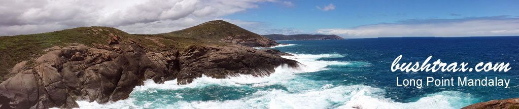
 Cape Arid Eucla
- StreetSmart®Travellers Atlas 9th Edition Map: 46 Grid Ref: D 5
- Roads and Tracks Western Australia 2005 Map:11 11a 2a 64 Grid Ref: E 4
- Road Reports: Shire of Esperance Shire of Dundas
The track into Alexander's Beach has been improved by the Esperance Shire council allowing camper trailers/boats easy access. The track that takes you to Kennedy' Beach at the intersection of Merrivale rd and Exchange rd has had gravel dumped at the first two mud sections (ES41 & ES42) and is a lot easier now. The track is still pretty chopped up as you get closer to the coast. There are small water holes that you may have to negoiate around also. Some of the gravel sections towards the coast require you pick your way over washed out stretches.


Thomas River has two main camping areas. The first one is the National Park site that lies at the end of a side road on the right after the Little Tagon Bay turnoff. The area itself is situated on the side of a hill, providing shelter and views of Yokinup Bay and Cape Arid. The second is the Shire campsite which is setback from the beach near the banks of the Thomas River. Both sites are excellent spots.
Tagon Beach can accessed by turning into the track at ES67. The track will take you to Tagon Creek where you will have to enter and follow the creek bed (ES68) to the mouth which spills onto Tagon Beach. There is only walking access to Dolphin Cove and Little Tagon Bay.


Yokinup Beach can be accessed by crosing the Thomas River mouth. During winter the mouth maybe closed. The beach is best driven along at low tide only. There is a coastal dune face that runs for about 10kms and does not allow any way off the beach at all.
The first feature along here is Point Jedacorrudup. Following the beach further brings you to a series of small headlands. The track leaves the beach and then travels over rocky terrain back onto another beach. Some of the headland tracks require a degree of ground clearance. Eventually the track ends at Arrid Bay.


The tracks into Thomas Fisheries and Hill Springs are easy to negoiate. The track runs along the base of Mt Arid and is generally hilly. There is camping at Thomas Fisheries, Jondee Creek and Seal Creek. The beaches east of Poison Creek can only be accessed by crossing the creek mouth and this may be closed in winter. The right hand side of the creek offers the best access, the middle can get quite deep. Upon crossing the creek, follow the wheel tracks along the beach until they swing left and up onto the ridge (ES82) that runs parrallel with the beach.
Following the track east will bring you to the rock climb at ES84 and there looks to be a detour around the climb on the left just before ES84 for vehicles with low ground clearance. The track will then follow the coastline for awhile until you come to a small beach at ES85. There is a track that runs up the hill just before you get on the beach, and may be a better option depending on the tide. From ES85 you will have to drive over or around a small rocky area to get onto the beaches east of this point.


Israelite Bay can be reached via Fisheries rd or The Telegraph Track that starts about 5km into Poison Creek rd. The Telegraph Track may be closed during winter. Fisheries rd can be muddy along sections of it during winter. The Telegraph Track is the better of the two options. The track to Bellanger Beach has very soft white sand with sections of capstone.
Point Malcom has a camping area setback from the Point itself behind a hill providing shelter from the prevailing wind. From the camping area you will see the track to Point Malcom go over this hill, if you look to your left there is another track. This sidetrack will take you onto the beach, where travelling a short way another track will take you off the beach and back onto the track to Point Malcom. Beawre that the small section of beach you have to travel, can become blocked with seaweed and turn into a bog.


Travelling from Pt Malcom to Isralite Bay takes you past the ruins at ES124 and then onto the mud flats, bringing you to the Telegraph Station at Isralite Bay. There are a collection of tracks in front of the Profesional Fishing camp that takes you to the coast. (ES84)The entry to the track through the cutting and onto the beach in front of the old jetty can be hazadous.


Gora rd is a sandy track at the Israelite Bay end, changing to rocky terrain about half way to Mt Ragged. Gora rd intersects with Ballodonia rd and the Mt Ragged turnoff is about 100m due north of here. Balladonia rd starts at Fisheries rd, as a series of waterholes in the track. There are detours towards the end of this terrain starting at ES169 and ending at ES175. From here the Balladonia rd changes to limestone running into gravel towards the Gora rd junction. Balladonia rd can be risky in the wet. Balladonia rd north of the of the Mt Ragged junction (ES183) can be badly corragated on the way to Balladonia.


