-
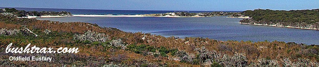
Balbinya Balbunya Toolina Cove

- Balladonia is the nearest fuel with limited supplies in the area. Alternative starting points are Norseman and Esperance. The tracks can be badly affected by rain which is not just confined to the winter months. The area is quite remote and a high degree of self sufficiency is required. The western access track to the beach run that takes you to the Baxter Cliffs is well past Wattle Camp due to the encroaching weed build up along the coast.
-
Contact: DPaW Esperance Phone: 08 9083 2100 92 Dempster Street Esperance DPaW Parks and Wildlife


 < @ Baxter Cliffs
 -
Nearest service:Esperance / Balladonia / Condinup

 <
< 
- Track Length: 622km Balbinya, Balbunya & Toolina Cove
-
 Eucla
Eucla
- Distance from Perth: Balladonia 934km Condingup 804km
- StreetSmart®Travellers Atlas 9th Edition Map: 107 Grid Ref: B 5
- Roads and Tracks Western Australia 2005 Map: 64 Grid Ref: B 6
-
Butty Head and Rose's Beach

- Butty Head is a short drive west of Esperance. The track to Roses Beach (western end) can be impassable during winter. The descent to Plumpudding Beach is a easy track though you will have to swing hard left across the rocks to get onto the beach
at the bottom. The track that takes you out to Butty Head has a very soft section at the bottom of the hill at BRB26, there is no run up off the beach. There are shifting sand dunes at BRB28 that may make the track impassable.
Roses Beach (west) can be accessed at the end of Murray rd which is about 35km west of the 11 Mile Beach rd and SW Highway junction. At the end of Murray rd the track starts straight ahead behind the trees (BRB40). The sign says it all from here for about 1.1kms where at BRB41 the track will swing to your left and travel along a fenceline. From here on the track will begin to open up and it is a very easy drive to the beach - Contact: DEC Esperance Phone: 08 9083 2100 92 Dempster Street Esperance
- Nearest service: Esperance
- Track Length: 33km
- Esperance
- Distance from Perth: Esperance 720km Then 19km out to 11 Mile Beach Road
- StreetSmart®Travellers Atlas 9th Edition Map: 46 Grid Ref: C 5
- Roads and Tracks Western Australia 2005 Map:11 Grid Ref: C 4
-
Cave Hill

- Travelling north of Cave Hill you are actually following the old railway line to Burra Rock. The track passes over some low country and you can see how the foundations were built up to form a causeway over these areas(CH18). The track over these areas is also a tight single lane in places so I don't know what you do with regards to an approaching vehicle. Washouts are common and the track will be closed during winter or times of inclement weather.
- Contact: DPaW Kalgoolie (08) 9080 5555 Kalgoolie DPaW Parks and Wildlife

 Old mineshafts
- Nearest service: Coolgardie or Norseman
- Track Length: 178km
- Distance from Perth: Coolgardie 546 km Higginsville Pump Station rd 655km
- StreetSmart®Travellers Atlas 9th Edition Map: 83 Grid Ref: B 2
- Roads and Tracks Western Australia 2005 Map:47 Grid Ref: A 6
-
Dundas to Balladonia
- Banker Mt Day rd is a gravelly track and can be tight in spots with regards to bush. The Old Hyden Norseman rd runs off the Queen Victoria Rock rd and can be adversely affected by rain. The road is not maintained nowadays. The Dundas-Balladonia telegraph line track has a causeway that may become flooded. The track itself can have fallen timber across it, though it is a easy track to traverse.
- Contact: DPaW Kalgoolie (08) 9080 5555 Kalgoolie
- Nearest service: Southern Cross, Norseman, Balladonia
- Track Length: 340km
- Distance from Perth: Southern Cross 375 km Balladonia 965km
- StreetSmart®Travellers Atlas 9th Edition Map: 82 Grid Ref: A 1
- Roads and Tracks Western Australia 2005 Map:45 Grid Ref: B 1
-
Esperance (East)

- The tracks east of Esperance offer a range of terrains. Beach driving can be hazardous and coastal tracks are generally soft sand with some rocky outcrops in places. Kennedy's Beach and Balladonia rd may become impassable in winter. Access to Thomas River and Poison Creek beaches may be closed if the creeks are in flood.
- Contact: DPaW Esperance Phone: (08) 9083 2100 92


- Nearest service: Esperance / Condingup
- Track Length: 389km
- Distance from Perth: Esperance 741 km Esperance to Condinup 69km
- Cape Arid Eucla
- StreetSmart®Travellers Atlas 9th Edition Map: 46 Grid Ref: D 5
- Roads and Tracks Western Australia 2005 Map:11 11a 2a 64 Grid Ref: E 4
-
Holland Track

- An easy track to negoiate in the dry months, though during the winter it will become impassable. There are a lot of bog holes which predominatley occur at the N/E end and S/W sections after the Bounty Gold Mine.
The track is well sign posted at HT01 which veers off Queen Victoria Road. At the first junction turning right will take you to Thursday Rock and give you an indication of what to expect with regards to track conditions. Heading S/W and onto Diamond Rock is fairly easy as the track runs through sandy soils except for the area between HT17 and HT31 where there are a series of bogholes. - Contact: DPaW Kalgoolie (08) 9080 5555 Kalgoolie DPaW Parks and Wildlife

- Nearest service:Coolgardie 558km / Hyden 339 km
- Track Length: Coolgardie to Hyden 410km
- Distance from Perth: Coolgardie(558km) then to HT01 80km
- StreetSmart®Travellers Atlas 9th Edition Map: 81 Grid Ref: D / 1
- Roads and Tracks Western Australia 2005
-
Munglinup Beach

-
Munglinup Beach and surrounding areas are very easy to traverse. The surrounding areas east and west of the caravan park can be regarded as day use areas. The Skippy Rock (MUN58) areas have designated camping and day areas as well. The caravan park at
Munglinup Beach is a community park. There are other options with regards to accommodation in the area.
Following Washpool rd west of here you will come to a side track at MUN20 and another one at MUN22. The MUN22 track travels very close to the actual beach and will enable walking access if the beach is to cut up for the 4WD. At MUN25 you can take the track directly to the beach or turn right at MUN26 to access the headland at MUN28. The track from MUN27 to MUN28 will require low tyre pressures. - Contact: Munglinup Beach Holiday Park
- Nearest service: Munglinup Roadhouse
- Track Length: 40 km
- Distance from Perth: Munglinup Beach Holiday Park 657km Munglinup Roadhouse 634km
-
Esperance
- StreetSmart®Travellers Atlas 9th Edition Map: 45 Grid Ref: C 5
- Roads and Tracks Western Australia 2005 Map:10 Grid Ref: E 2
-
Stokes Inlet and Quagi Beach

- Contact:DEC Esperance DEC Esperance Phone: 08 9083 2100 92 Dempster Street Esperance
- Nearest service: Munglinup Roadhouse 26km
Esperance 37km
- Distance from Perth: Quagi Beach 688km
- Track Length: Stokes National Park (Quagi Beach) 30km
- Esperance
- StreetSmart®Travellers Atlas 9th Edition Map: 46 Grid Ref: A 5
- Roads and Tracks Western Australia 2005 Map: 11 Grid Ref: B 3